


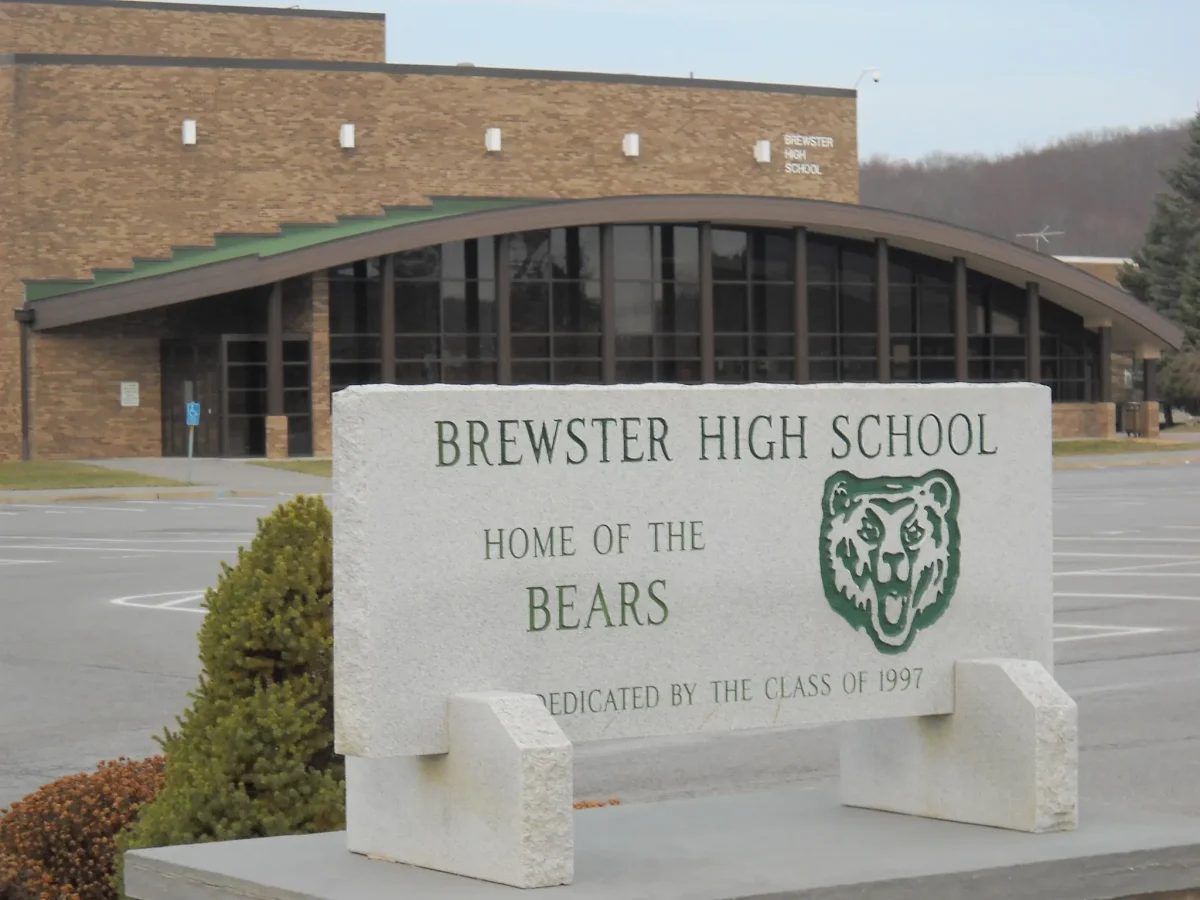


If you have ever sat on the terraced patio of Las Mañanitas, the beloved Mexican restaurant perched on a hillside along Route 22 in Brewster, New York, you have looked out over one of the Hudson Valley’s best-kept secrets. The reservoir stretching below you, glimmering in the afternoon sun, looks peaceful and eternal — a natural feature of the landscape. But the East Branch Reservoir is not natural at all. It is a grave. Beneath those tranquil waters lie the remnants of communities that were deliberately flooded more than 130 years ago, sacrificed so that New York City could drink.
By the mid-19th century, New York City was growing at a pace that no one had quite anticipated. The population was exploding, industry was booming, and the city’s need for clean, reliable water had become urgent. In 1842, the city had already completed the Old Croton Aqueduct, an engineering marvel that carried water from the Croton River in Westchester County some 41 miles south into Manhattan. But even that proved insufficient. The city’s engineers turned their eyes northward, into the rolling hills of Putnam County.
The plan was ambitious: dam the East Branch of the Croton River near Brewster and create an enormous reservoir that would feed the expanding Croton Water Supply System. The engineering was straightforward enough. The human cost was another matter entirely.
Standing in the valley at the time was Southeast Center, the civic heart of the Town of Southeast. It was a quintessential 19th-century American village — a place of churches, homes, farms, and community life that had developed organically over generations. Families had put down roots here, built businesses, buried their dead, and shaped a community that felt permanent and self-contained.
When the New York City Board of Water Supply determined that the valley needed to be flooded, the residents of Southeast Center had little recourse. Eminent domain made the outcome inevitable. Homes were condemned, plots were surveyed, and the slow machinery of displacement was set in motion. By the time the Sodom Dam was completed and the waters began to rise, Southeast Center had ceased to exist as a living place. The village was leveled and submerged. What had taken generations to build was erased in a matter of years.
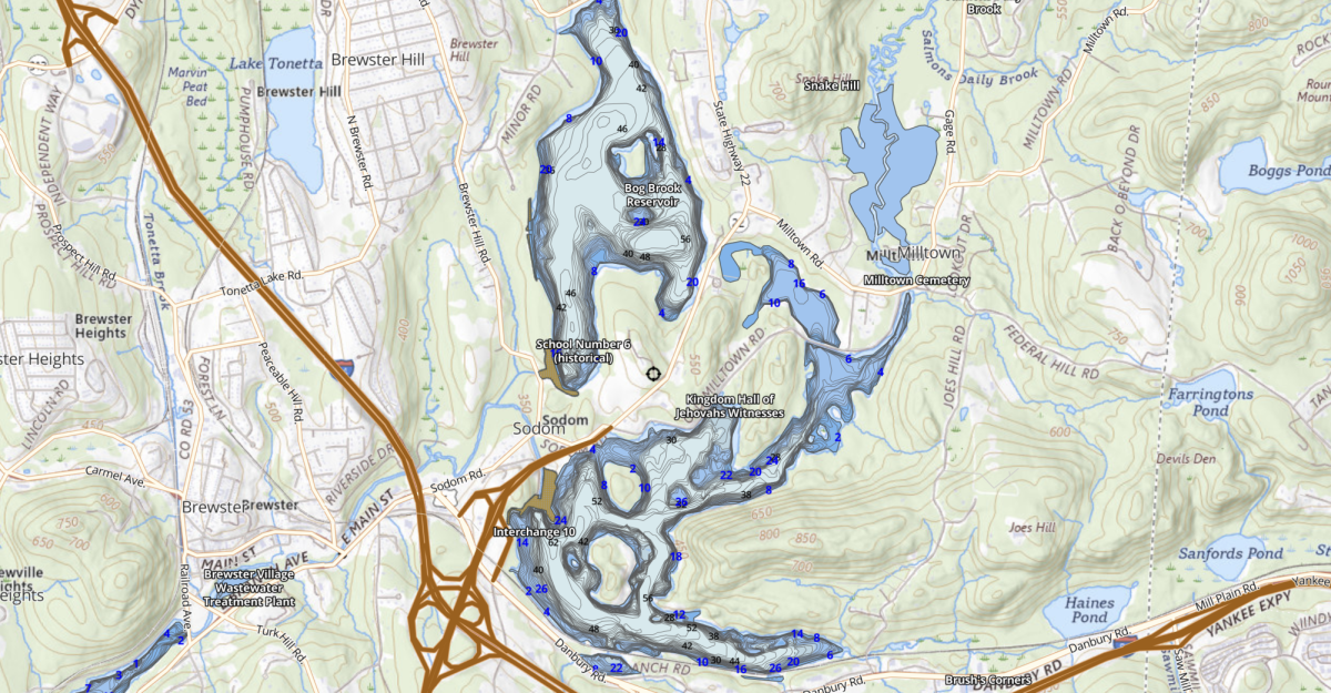
The reservoir was placed into service in 1891. At full capacity it holds 5.2 billion gallons of water, spreads across 525 acres, and reaches a depth of 62 feet at its deepest point. The old Sodom Road — named for the hamlet of Sodom that once existed nearby — still exists at the foot of the dam, a ghostly reminder of the landscape that was. Even the reservoir’s nickname, the “Sodom Reservoir,” is an echo of what was lost.
Southeast Center was not the only community affected. The village of Milltown, tucked into the northeastern corner of Southeast near present-day Deforest Corners, also lay in the path of the rising waters. But Milltown had a slightly different fate. Rather than being entirely demolished and drowned, many of the village’s original buildings were physically relocated to higher ground. They were moved, structure by structure, onto what is now Milltown Road, one of Southeast’s longest roads, running from New Fairfield, Connecticut, all the way to Route 22.
Those buildings still stand today, hiding their extraordinary origin story in plain sight. When you drive down Milltown Road, you may be passing homes that were once somewhere else entirely, dragged uphill to safety while their old neighborhood drowned below.
The East Branch Reservoir is part of New York City’s sprawling Croton Water Supply System, one of 12 reservoirs in the network. Water from the East Branch flows into the Diverting Reservoir, then into the Muscoot and New Croton Reservoirs, and eventually through the New Croton Aqueduct into the Jerome Park Reservoir in the Bronx, where it enters New York City’s distribution system. Every glass of Croton water poured in a New York City kitchen carries, in some sense, the memory of Southeast Center.
Beneath the surface, the old village does not entirely disappear. Foundations, stone walls, and the remains of 19th-century structures still exist on the reservoir floor. Fishermen who work the East Branch know this well. The lake-link fishing guides for the reservoir specifically recommend casting around old submerged foundations when targeting walleye and panfish. The ruins of Southeast Center, it turns out, make excellent fish habitat.
The story of Southeast Center is not unique. Across the Catskills and Hudson Valley, New York City’s insatiable need for water claimed community after community throughout the 19th and 20th centuries. The Ashokan Reservoir in Ulster County submerged a dozen hamlets when it was completed in 1915. The Pepacton Reservoir swallowed four Catskill hamlets — Pepacton, Union Grove, Shavertown, and Arena — in the 1950s. The Neversink Reservoir drowned the towns of Neversink and Bittersweet in 1953. In each case, families were displaced, cemeteries were relocated, and the physical fabric of community life was torn up and discarded.
In drought years, when water levels drop significantly, the past sometimes resurfaces. Residents near the Ashokan Reservoir have reported seeing the tops of old barns and stone foundations emerge from the receding water, ghostly reminders that the landscape was once something else entirely.
Back on the patio at Las Mañanitas, the margaritas are cold and the view is undeniably stunning. Reviewers consistently rave about the panorama, the hills, the water, the sense of open space that is increasingly rare in this part of the Northeast. The restaurant has been drawing diners for years with exactly this combination: good food, warm hospitality, and that remarkable view over the reservoir.
But now, perhaps, that view carries a little more weight. The water below is not just a scenic backdrop. It is the end result of a deliberate, irreversible act of erasure, a decision made in the name of urban progress that cost a rural community everything it had built. The residents of Southeast Center did not choose to disappear. They were made to.
So the next time you find yourself at a table overlooking the East Branch Reservoir, take a moment to look beyond the beauty of the water. Somewhere beneath that shimmering surface, under 130 years of accumulated silt and silence, a village is still there, waiting, as all forgotten things do, to be remembered.
